How to Spend 24 Hours in Capitol Reef National Park | Utah Mighty 5 Road Trip
- apriladventuring

- Apr 3, 2024
- 8 min read
Updated: May 8, 2024
The Mighty 5 National Parks in Utah are an incredible way to experience the array of natural wonders the state has to offer. A road trip through these parks will bring you through stunning canyons, over rocky peaks, and under massive arches -- all in one week! I highly recommend getting yourself an America the Beautiful National Park Pass before heading off on this trip.
In this series, I'm taking you on a journey through the Mighty 5. It's broken down by each park for easier consumption and for those that are looking for info on just one or two instead of the entire five. I'm giving all the juicy details of the parks, including where I would definitely hit with more time or skip if I'm in a rush.
You can also view the entire trip in video form here!
In this leg, we're exploring Capitol Reef National Park. This was the third park I visited on my road trip after Arches. Capitol Reef sits along the most easily accessible section of the Waterpocket Fold, which is essentially a geologic wrinkle on the surface of the earth. This huge rift is what creates the stunning cliffs and rock formations we get to enjoy in the park.
I'm describing the itinerary here as I've done it across two half-days, but feel free to combine everything into one day if it fits your schedule! In fact, I'll point out recommendations for different timings at some of the stops compared to what I did.
We've got tons to see, so let's get started!
Highlights:
Grand Wash Trail (4.4 miles)
Hickman Bridge Trail (1.8 miles)
Capitol Gorge Trail to The Tanks (2.0 miles)
Panorama Point (0 miles)
Fruita Campground
Goosenecks Point (0.2 miles)
Sunset Point (0.8 miles)
Chimney Rock Loop (3.6 miles)
Total mileage: 12.8+/- miles (variable depending on miles hiked at Grand Wash, I only did around 2 so my total mileage was closer to 10.4 miles!)
Favorite Adventures: The Windows Trail, Double Arch, Park Ave, Goblin Valley State Park, Hickman Bridge Trail, the Scenic Drive, and Chimney Rock -- lots of goodies!
Check out this leg of my road trip in this video!
Capitol Reef is probably the most overlooked National Park of the Mighty 5, but should definitely be on your road trip itinerary! There are so many amazing hikes, arches, canyons, and the most stunning multi-colored rock formations.

I kicked off my time in the park by checking out a quick hike on the way to my campsite for the night. The trailhead for Grand Wash is along the side of Utah's State Route 24, which hugs the Fremont River during this stretch of road. Driving over from Arches and Goblin Valley, you'll pull over on the left side to hit this trail.

The trail itself brings you through a deep sandstone canyon -- there's no way to get lost in here as you simply follow the narrow passage. It connects to a few other trails, so you could theoretically pop out the other end all the way over in the Fruita Campground. For now, I strolled somewhere between one and two miles into the canyon before heading back the way I came.
If you have extra time here, I'd recommend hiking out to Cassidy Arch! If I returned here, I would take the trailhead from the spur road off the Scenic Drive and hike to Cassidy Arch.
Next up, we're driving a few minutes down the road to the trailhead for Hickman Natural Bridge. This 1.8-mile hike takes you to a beautiful bridge carved out of the sandstone. Its huge size arcs over the trail with a 133-foot span!

Fun fact: Did you know bridges are arches that go over water? That means Hickman Bridge was formed by flowing water many years ago, while most arches are formed instead by wind.
Hickman Bridge is a fun trail that starts by following the Fremont River before veering the opposite direction and heading steadily uphill. You'll climb around 400 feet by the time you reach the bridge, looping underneath it to turn around toward the trailhead. Keep an eye out for the beautiful Capitol Dome while on your way back to the parking area.

If you're looking for a longer hike, the same trailhead will also lead you to the Rim Overlook (4.6 miles roundtrip) and Navajo Knobs (9.4 miles roundtrip). You'll have a much more strenuous journey, climbing over 1,600 feet by the time you reach Navajo Knobs, but you'll be rewarded with panoramic views of the area.
I didn't complete the longer trail this time, but would love to come back and check it off my list. The area is totally stunning! Instead of the hike, I was off to explore one of the main attractions of the park: the Scenic Drive.

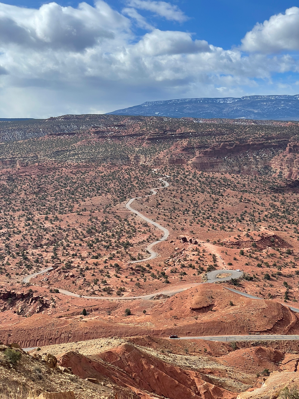
The Scenic Drive is an 8-mile paved road past the campground and through the center of the park. There are also two dirt, side roads that you can take to the trail heads for Grand Wash and Capitol Gorge.
Disclaimer here: Capitol Reef is planning a rehabilitation project of the scenic drive that is scheduled to start in April and end in October of 2024. Check here for the latest news. If you visit during the project, this drive will be closed! Fortunately, this temporary closure will result in improved roads and parking areas throughout the park.
If you do get to visit the scenic drive, I highly recommend pulling up the guide on the NPS website. This virtual tour gives you fun info about 11 stops along the drive. You'll see parking areas where you can pull off the road and admire some of the highlights along the route. The entire drive is gorgeous though!
Give yourself around one and a half hours to complete the driving tour and make it back to camp. We're going to squeeze in a little more adventure before calling it for the day. When you reach the end of the paved road, continue on the dirt track for a couple miles into Capitol Gorge. At the very end, you'll find a small parking lot at the trailhead for Capitol Gorge that leads to either The Tanks or the viewpoint for the Golden Throne.

When I visited, I had just around an hour of daylight left, so opted for the shorter hike to The Tanks. This hike takes you a mile into the canyon, past the incredible "pioneer register," and to the natural water pools called the tanks. These pools are permanently filled, making them crucial sources of hydration for local animals, including some that call these pools home! Capitol Reef is home to a couple types of shrimp that reside in these pools year-round.

Photo taken from the NPS website here.
Pro tip: The Tanks should absolutely not be touched or disturbed in any way. Products on our clothes and skin, as well as our skin oils, can harm the organisms in the pools. You don't want to damage the fragile ecosystems living there!
Keep in mind as your exploring Capitol Reef that the sun dips behind the canyon walls earlier than the actual sunset time. Make sure to give yourself enough time to complete your hikes before the light disappears. I wrapped up my quick stop at The Tanks before hustling back to my car just as the sun was starting to slide out of sight.
I had time for one more super fast stop, checked my map for saved viewpoints that didn't require hiking, and spotted Panorama Point. Perfect! I drove out to the viewpoint on a small hill and took in the sunset.

This was also one of the few places in Capitol Reef where I had cell service. This gave it the added bonus of allowing me to check in with people back home and let them know I was still alive. I also kept my Duolingo streak going. 🦉(Let's be friends! Add apriladventuring and send me a message so I know to add you back. 😊)
A relaxing drive back in the dusk light and I was ready for dinner and sleep. It had been an action-packed day with two national parks and a state park!
Tonight, we're staying at the beautiful and conveniently-located Fruita Campground in the middle of Capitol Reef NP. There are 71 sites that cost $25/night and 65 of which are fully on a reservation system from March through October (the rest are used for administration).
If you time it right, you can even pick fresh fruits and nuts from the trees all around the camp: cherry, apricot, peach, pear, apple, plum, mulberry, almond and walnut. I was a too early in the season, but it sounds so dreamy to have fresh fruit available right at your campsite.
Whether your belly is full of fruit or not, get a good night's sleep and rest up for our day tomorrow. We'll be finishing up Capitol Reef and heading over the to stunning Bryce Canyon National Park.
Good morning! How are you feeling now that you're at the halfway point of this epic trip? We've got two and a half parks left to explore and so many incredible places to see, so let's continue on.
We're starting this morning with three hikes of varying lengths that will round out our time at Capitol Reef. The first two are quick ones that start from the same trailhead.
Goosenecks Point is first on our agenda and is a nice warm-up for the day at just 0.2 miles. You'll take a short path from the parking area up to the viewpoint. From here, look down at the winding Sulphur Creek below. The hairpin turns are the "goosenecks" that gave this overlook its name.

Heading back down to the parking area, head left from the Goosenecks trailhead to find the sign for Sunset Point (apologies for the lack of photo -- the sun was really working against me at this stop). This is a slightly longer 0.8 miles roundtrip. Our legs are still warming up for our longest hike of the morning! Admire the awesome canyon and cliff walls below.
Pro tip: I visited Sunset Point in the morning, but I'd recommend checking it out at...sunset! The angle of the cliffs here makes this spot better suited for viewing in the afternoon when the rock faces get lit up.
Hop back in your car and make the short drive over to Chimney Rock. This was the most difficult hike I did while in Capitol Reef, but it was completely worth it. It’s a 3.6-mile loop trail that brings you to incredible views of the area.

You’ll start at over 6000 feet and climb 590 feet over the course of this loop, making it a strenuous stop. Remember to bring plenty of water and watch your footing as there are sheer drop-offs at many points along the trail and huge gusts of wind. It even started snowing in the middle of my hike and the cold and wind were actually really rough!

I visited mid-morning on a Wednesday and there were only a couple other people here though. Capitol Reef is a great park to visit if you’re looking for amazing views and a some solitude. 😌
At this point in my trip, I had three hikes already under my belt and it was just before 11 in the morning. It was a short trip, but it was time to say goodbye to Capitol Reef and move onto park number four: Bryce Canyon.
Last pro tip: Check the weather and road conditions in Boulder Mountain before making this drive, especially if you're visiting during the colder months. My Airbnb host for the Bryce Canyon leg of my road trip graciously offered the advice to wait until after 11 a.m. to drive through this pass, which is situated at over 10,000 feet above sea level! I was thankful to avoid icy roads.
Thanks for coming along on this journey with me and I hope to see you out there.
Happy adventuring,
A


Comments